The UK is bracing itself for the impact of Storm Henk as an amber wind warning has been issued by the Met Office. Parts of southern England, the Midlands, East Anglia, and Wales are expected to be the hardest hit, with gusts of up to 80mph predicted. The warning is in place from 10am until 8pm today, and it is anticipated that there may be disruption to travel and the potential for “flying debris” that could result in injuries or danger to life. It is crucial for residents in affected areas to stay updated with the latest weather forecast for their specific location.
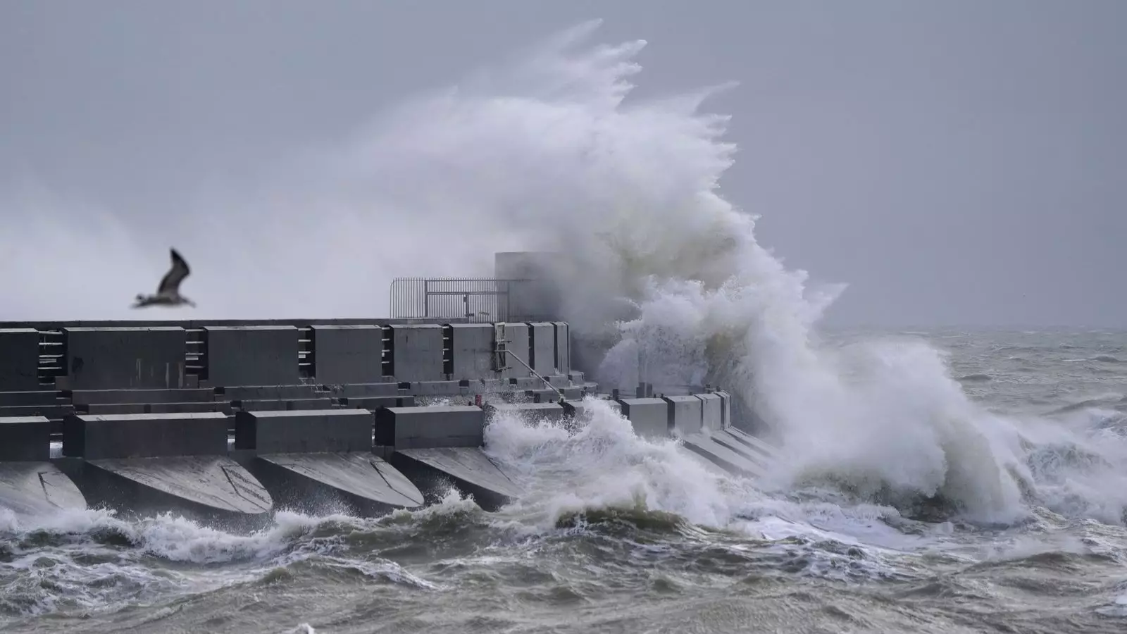
Aside from the amber warning, a less severe yellow warning for wind covers the entire southern England and Wales region until 9pm today. People living near the coast have been advised to avoid walking near crashing waves, as there is a risk of being dragged out to sea. The Met Office has issued a statement regarding the amber warning, stating that strong winds will arrive late morning and early afternoon in southwest England and south Wales, before progressing to southern England, the south Midlands, and East Anglia throughout the afternoon and evening. Exposed coastal areas in the west are likely to experience gusts of 70-80mph, while inland regions can expect gusts of 50-60mph, potentially slightly higher in isolated areas.
To ensure safety during the storm, motorists are advised to drive slowly, taking extra care on the roads. Homeowners should secure any loose objects or garden furniture that may be susceptible to the strong winds. Taking these precautions can help prevent accidents or property damage.
In addition to the wind warnings, a yellow warning for rain has been issued across a significant stretch of the country, extending as far as Manchester and Hull, until 9pm today. The Met Office predicts that some areas may experience rainfall amounts of 35-50mm. The most intense rainfall is expected to clear southwestern areas of England and South Wales by midday, although it may persist into the evening in the northeastern parts of the warning area. As a result, drivers should anticipate spray and flooding on the roads, potentially causing longer journey times. Bus and train services may also face delays due to the adverse weather conditions.
Throughout England and Wales, over 115 flood warnings have been issued, predominantly in the Midlands, along with over 320 flood alerts. In Scotland, five alerts and one warning have been issued, advising the public of areas where flooding is expected or possible. Flood warnings serve to inform the community of specific locations where flooding is anticipated, while the less severe flood alerts indicate areas where flooding may occur. Residents in flood-prone areas should stay vigilant and listen to local authorities for any emergency instructions or evacuation notices.
With the arrival of Storm Henk, the UK is facing the strong winds and heavy rain that come with it. It is crucial for individuals to prioritize their safety, follow the advice of authorities, and stay informed regarding weather updates. By taking precautionary measures and staying prepared, residents can minimize the risks associated with severe weather conditions and ensure the well-being of themselves and their communities.
Leave a Reply