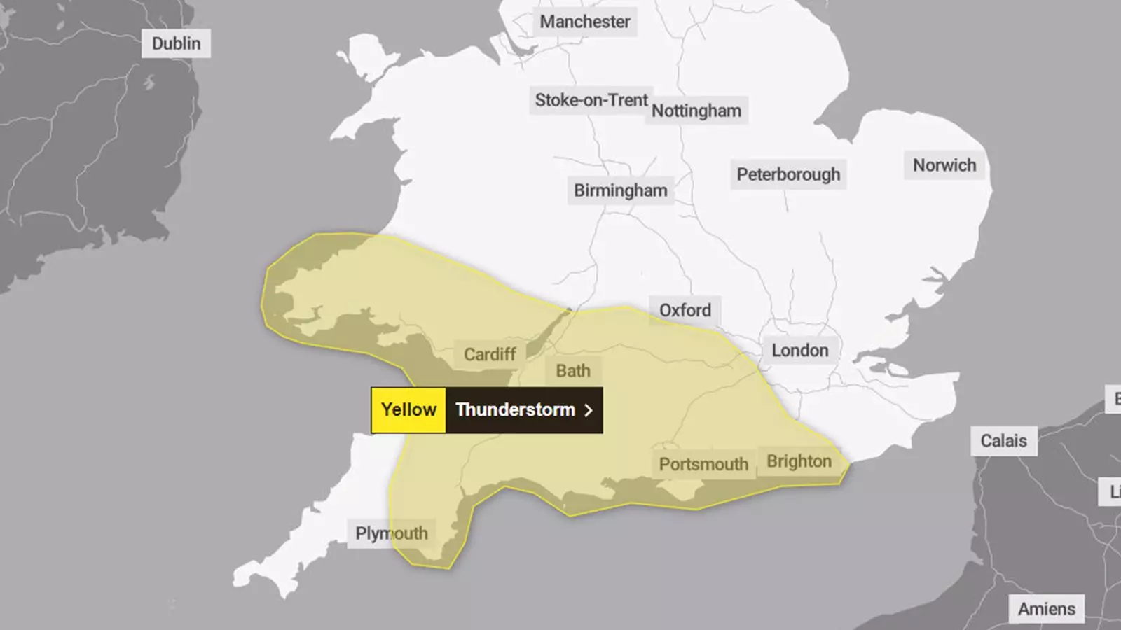
As weather systems evolve and shift, the UK finds itself bracing for an intense period of thunderstorms accompanied by heavy rainfall. Forecasts indicate a stark change in conditions later today, with the Met Office issuing a yellow weather warning effective from 4 PM until midnight. This advisory encompasses significant portions of South Wales, South West England, and southern England, urging residents and travelers to exercise caution.
The yellow weather warning signifies a moderate risk of adverse weather conditions that could lead to disruption in everyday activities. In this case, meteorologists predict the potential for up to 40mm of rain falling in just two to three hours in certain locations. The intensity of the rainfall raises concerns about flooding, which could severely disrupt travel and lead to localized power outages. The Met Office warns that visibility on the roads may be compromised due to spray, standing water, or even hail. These factors pose significant risks for drivers, especially in regions known to be prone to water accumulation.
Trains are also expected to face delays or cancellations, adding to the challenges travelers may face due to inclement weather. As the situation develops, the local infrastructure’s ability to handle such sudden rainfall will be tested, particularly in urban areas where drainage systems may struggle to cope.
Forecasters have indicated that thunderstorms are most likely to materialize along south-facing coastal regions, where strong winds and hail may occur alongside the heaviest rain. This forecast has been corroborated by meteorological observations, confirming that these coastal areas often experience more volatile weather conditions.
In central and southern parts of the UK, heavy showers and thunderstorms are anticipated to persist into Tuesday and possibly extending into Wednesday. As these storms approach, residents should be prepared for the possibility of floodwaters affecting homes and businesses. The risk of a short-term loss of power further complicates the situation, emphasizing the need for preparedness.
An intriguing development in this weather scenario is the expected track of ex-Hurricane Kirk, which, while originally a concern for the UK, seems to be veering southeast towards northern France. Although there remains a degree of uncertainty surrounding its trajectory, forecasts now suggest that the UK may avoid significant impacts from this system. This alleviation comes as a relief, particularly following a damp start to the month that has already led to isolated flooding incidents in places like Norfolk.
Chief meteorologist Frank Saunders from the Met Office has provided insights into the weather dynamics at play. He notes that after today’s intense weather, temperatures are poised to drop in the north, with all regions likely experiencing below-average conditions starting Thursday. This temperature drop could signal the onset of night frosts in some regions, with the potential for snow accumulation in higher areas of Scotland later in the week.
Given the forecast and the accompanying warnings from the Met Office, it is vital for residents in the affected areas to remain vigilant. Understanding the risks and taking proactive steps can mitigate the dangers associated with severe weather. Residents are advised to secure loose items in their yards, stay updated through the Met Office or reliable news sources, and avoid unnecessary travel during storms.
While the impending thunderstorms may bring about significant challenges, being informed and prepared is key to navigating through these tumultuous weather conditions. The lull that may follow today’s storms could provide a brief respite, but the realities of a shifting climate mean that adaptability and vigilance will remain essential in facing whatever Mother Nature has in store.


Leave a Reply